
Make a donation
Gear up for your next adventure:
As an Amazon Associate, this site earns from qualifying purchases at no extra cost to you.
Raichur topographic map
Click on the map to display elevation.
Make a donation
Gear up for your next adventure:
As an Amazon Associate, this site earns from qualifying purchases at no extra cost to you.
Raichur
Raichur is located at 16°12′N 77°22′E / 16.2°N 77.37°E / 16.2; 77.37 on Deccan plateau. It has an average elevation of 407 metres (1335 ft)
Make a donation
Gear up for your next adventure:
As an Amazon Associate, this site earns from qualifying purchases at no extra cost to you.
About this map
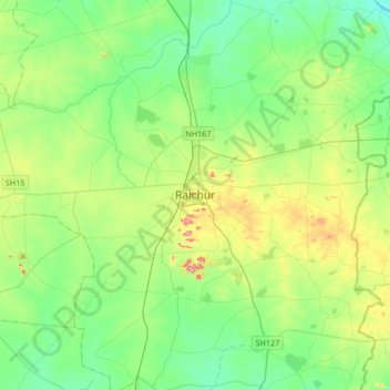
Name: Raichur topographic map, elevation, terrain.
Location: Raichur, Rayachuru taluku, Raichur, Karnataka, 584100, India (16.03832 77.19274 16.35832 77.51274)
Average elevation: 378 m
Minimum elevation: 320 m
Maximum elevation: 531 m
Make a donation
Gear up for your next adventure:
As an Amazon Associate, this site earns from qualifying purchases at no extra cost to you.