Geolocate

Elizabeth topographic map

Click on the map to display elevation.

About this map

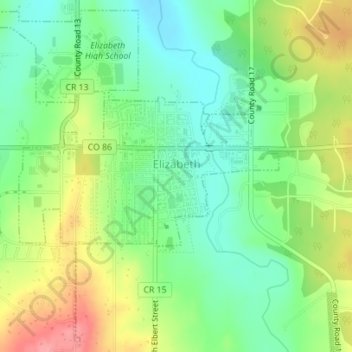
Name: Elizabeth topographic map, elevation, terrain.

Location: Elizabeth, Elbert County, Colorado, United States (39.34660 -104.61685 39.37206 -104.58673)

Average elevation: 1,991 m

Minimum elevation: 1,954 m

Maximum elevation: 2,048 m

Gear up for your next adventure:

🥘Camping Cookware Set - Compact nesting pots and pans for trail cooking
🥾Mountain Hiking Shoes - Shoes with superior grip for mountainous terrain
💧Hydration Bladder - Hands-free hydration solution for long treks
💡Solar Camping Lamp - Eco-friendly lighting for campsites
🥾Trekking Boots - Durable boots for long-distance trekking

As an Amazon Associate, this site earns from qualifying purchases at no extra cost to you.