
Thank you for supporting this site ❤️
Make a donation
Make a donation
Gear up for your next adventure:
As an Amazon Associate, this site earns from qualifying purchases at no extra cost to you.
Berlin-Neukölln topographic map
Click on the map to display elevation.
Thank you for supporting this site ❤️
Make a donation
Make a donation
Gear up for your next adventure:
As an Amazon Associate, this site earns from qualifying purchases at no extra cost to you.
About this map
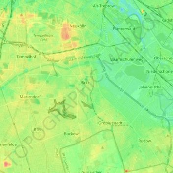
Name: Berlin-Neukölln topographic map, elevation, terrain.
Location: Berlin-Neukölln, Berlin, Teltow, Brandenburg, Germany (52.39595 13.39949 52.49587 13.52413)
Average elevation: 43 m
Minimum elevation: 23 m
Maximum elevation: 72 m
Thank you for supporting this site ❤️
Make a donation
Make a donation
Gear up for your next adventure:
As an Amazon Associate, this site earns from qualifying purchases at no extra cost to you.