Geolocate

Kollengode topographic map

Click on the map to display elevation.

About this map
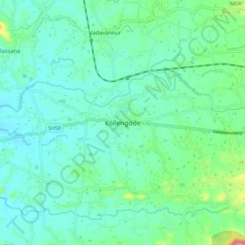
Name: Kollengode topographic map, elevation, terrain.

Location: Kollengode, Chittur, Palakkad, Kerala, 678506, India (10.57254 76.65739 10.65254 76.73739)

Average elevation: 103 m

Minimum elevation: 79 m

Maximum elevation: 197 m

Other topographic maps

Click on a map to view its topography, its elevation and its terrain.

Parambikulam

India > Kerala > Chittur

Average elevation: 696 m

Meenkara Dam

India > Kerala > Chittur > Govindapuram

Average elevation: 155 m

Chittur-Thathamangalam

India > Kerala > Chittur > Manchira

Average elevation: 117 m

Kaikatty

India > Kerala > Chittur

Average elevation: 929 m

Gear up for your next adventure:

🧤Thermal Hiking Gloves - Grip-enhanced gloves for cold-weather altitude trekking
🧣Merino Neck Gaiter - Protects against wind, sun, and cold at high altitudes
🥾Waterproof Hiking Shoes - Durable shoes for wet and rugged trails
🛶Canoe Life Vest - Safety vest for water sports
🛶Waterproof Dry Bags - Keep electronics and clothes dry during river crossings

As an Amazon Associate, this site earns from qualifying purchases at no extra cost to you.