Geolocate

Kilmarnock topographic map

Click on the map to display elevation.

About this map
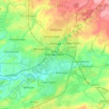
Name: Kilmarnock topographic map, elevation, terrain.

Location: Kilmarnock, East Ayrshire, Scotland, KA1 1LL, United Kingdom (55.57006 -4.53647 55.65006 -4.45647)

Average elevation: 56 m

Minimum elevation: 12 m

Maximum elevation: 128 m

Gear up for your next adventure:

🔥Camping Stove - Portable stoves to cook outdoors with ease
🥾Hiking Gaiters - Protect legs and shoes from mud, snow, and debris
🥘Camping Cookware Set - Compact nesting pots and pans for trail cooking
🎒Backpack Rain Cover - External shield to keep your entire pack dry
🧦Thermal Socks - Warm socks for winter hiking or camping

As an Amazon Associate, this site earns from qualifying purchases at no extra cost to you.