Geolocate

Saint-Roch-de-Richelieu topographic map

Click on the map to display elevation.

About this map
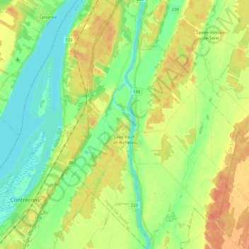
Name: Saint-Roch-de-Richelieu topographic map, elevation, terrain.

Location: Saint-Roch-de-Richelieu, Pierre-De Saurel, Montérégie, Quebec, J0L 2M0, Canada (45.82958 -73.20406 45.96863 -73.13871)

Average elevation: 18 m

Minimum elevation: 1 m

Maximum elevation: 38 m

Pierre-De Saurel trails, hiking, mountain biking, running and outdoor activities

Gear up for your next adventure:

💧Hydration Pack - Hands-free hydration system for long hikes
🏕️Camping Hammock - Integrated protection for sleeping between trees
🥾Waterproof Hiking Shoes - Durable shoes for wet and rugged trails
🛶Kayak Dry Bag - Waterproof storage for kayaking adventures
🧢Hiking Hat - Sun-protective and breathable hats for long treks

As an Amazon Associate, this site earns from qualifying purchases at no extra cost to you.