Geolocate

Warmley topographic map

Click on the map to display elevation.

About this map
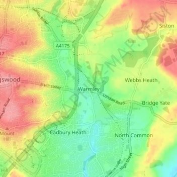
Name: Warmley topographic map, elevation, terrain.

Location: Warmley, Siston, South Gloucestershire, West of England, England, BS15 4PP, United Kingdom (51.44056 -2.49785 51.48056 -2.45785)

Average elevation: 69 m

Minimum elevation: 27 m

Maximum elevation: 116 m

Other topographic maps

Click on a map to view its topography, its elevation and its terrain.

Yate

United Kingdom > England > South Gloucestershire

Average elevation: 83 m

Gear up for your next adventure:

🍽️Titanium Camping Spork - Ultralight and indestructible eating utensil
🧤Insulated Winter Gloves - Heavy-duty protection for sub-zero Canadian adventures
🥾Approach Boots - Comfortable boots for hiking and climbing approaches
🥾Trail Hiking Shoes - Durable shoes designed for rugged trails
🧢Sun Protection Cap - Breathable cap to protect from sun exposure

As an Amazon Associate, this site earns from qualifying purchases at no extra cost to you.