Geolocate

Döbeln topographic map

Click on the map to display elevation.

About this map

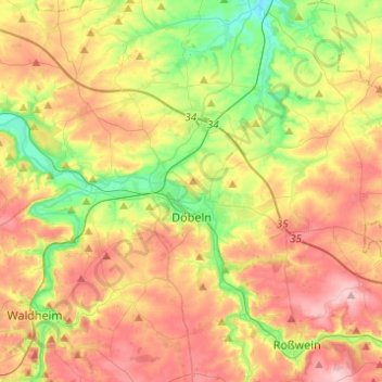
Name: Döbeln topographic map, elevation, terrain.

Location: Döbeln, Mittelsachsen, Saxony, 04720, Germany (51.07827 13.01379 51.17577 13.25907)

Average elevation: 229 m

Minimum elevation: 142 m

Maximum elevation: 324 m

Gear up for your next adventure:

🔭Outdoor Binoculars - Lightweight binoculars for birdwatching and hiking
🥾Lightweight Hiking Boots - Boots for comfort and mobility on long hikes
Camping Coffee Maker - Brew fresh coffee anywhere on the topographic map
🧊Portable Cooler - Keep food and drinks cold during outdoor adventures
🗺️Topographic Maps - Detailed maps to explore trails, mountains, and wilderness areas

As an Amazon Associate, this site earns from qualifying purchases at no extra cost to you.