Geolocate

Riotorto topographic map

Click on the map to display elevation.

About this map

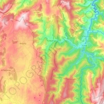
Name: Riotorto topographic map, elevation, terrain.

Location: Riotorto, Meira, Lugo, Galicia, Spain (43.25188 -7.31976 43.39938 -7.20352)

Average elevation: 445 m

Minimum elevation: 52 m

Maximum elevation: 826 m

Other topographic maps

Click on a map to view its topography, its elevation and its terrain.

Castro

Spain > Galicia > Meira > Riotorto

Average elevation: 375 m

Gear up for your next adventure:

Bushcraft Tarp - Versatile emergency shelter or gear protection
🧥Insulated Jacket - Keep warm in cold outdoor conditions
🔦UV Flashlight - Detect minerals or specific insects in the dark
💡Solar Camping Lamp - Eco-friendly lighting for campsites
🧤Rechargeable Heated Gloves - Extreme warmth for Canadian winter expeditions

As an Amazon Associate, this site earns from qualifying purchases at no extra cost to you.