Geolocate

Crystal Falls topographic map

Click on the map to display elevation.

About this map
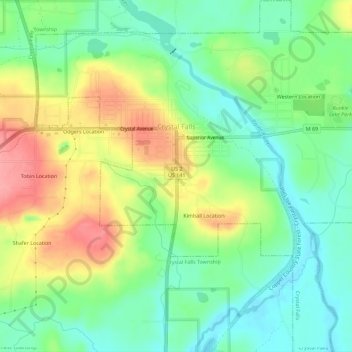
Name: Crystal Falls topographic map, elevation, terrain.

Location: Crystal Falls, Iron County, Michigan, United States (46.07265 -88.35676 46.11211 -88.30489)

Average elevation: 428 m

Minimum elevation: 390 m

Maximum elevation: 486 m

Other topographic maps

Click on a map to view its topography, its elevation and its terrain.

Hiawatha

United States > Michigan > Iron County > Iron River > Stambaugh

Average elevation: 474 m

Gear up for your next adventure:

🥾Hiking Leggings - Comfortable leggings for outdoor activities
🦶Anti-Blister Balm - Prevents friction and hotspots during long ascents
🧥Thermal Layer - Insulating layer for cold outdoor conditions
🧊Portable Cooler - Keep food and drinks cold during outdoor adventures
🥾Hiking Shorts - Breathable shorts suitable for summer hikes

As an Amazon Associate, this site earns from qualifying purchases at no extra cost to you.