Geolocate

Amana topographic map

Click on the map to display elevation.

About this map

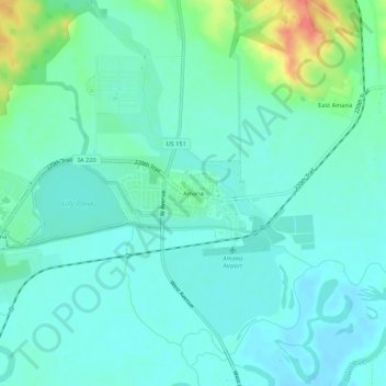
Name: Amana topographic map, elevation, terrain.

Location: Amana, Iowa County, Iowa, 52203, United States (41.78001 -91.89073 41.82001 -91.85073)

Average elevation: 222 m

Minimum elevation: 209 m

Maximum elevation: 268 m

Gear up for your next adventure:

🥾Hiking Shoes - Durable and comfortable shoes for trail hiking
🧣Evaporative Cooling Towel - Beat the heat during intense summer climbs
🔦UV Flashlight - Detect minerals or specific insects in the dark
🔭Outdoor Binoculars - Lightweight binoculars for birdwatching and hiking
🕶️Polarized Sunglasses - Reduces glare from snow and water at high elevations

As an Amazon Associate, this site earns from qualifying purchases at no extra cost to you.