Geolocate

Ennis topographic map

Click on the map to display elevation.

About this map
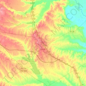
Name: Ennis topographic map, elevation, terrain.

Location: Ennis, Ellis County, Texas, 75119, United States (32.26156 -96.76000 32.43431 -96.44661)

Average elevation: 136 m

Minimum elevation: 98 m

Maximum elevation: 176 m

Gear up for your next adventure:

🚲MTB Frame Bag - Carry tools and maps directly on your bicycle frame
🧥Ultralight Puffy Jacket - Maximum warmth that packs down to the size of an orange
💧Hydration Bladder - Hands-free hydration solution for long treks
🥾Waterproof Hiking Boots - Boots keeping your feet dry in wet conditions
🧥Fleece Jacket - Warm and lightweight jacket for layering

As an Amazon Associate, this site earns from qualifying purchases at no extra cost to you.