Geolocate

Gudivada topographic map

Click on the map to display elevation.

About this map

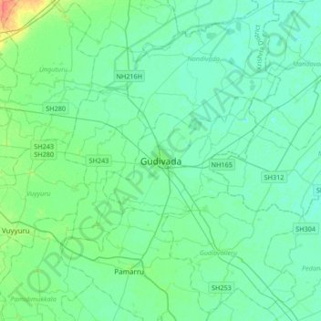
Name: Gudivada topographic map, elevation, terrain.

Location: Gudivada, Krishna District, Andhra Pradesh, 521300, India (16.27300 80.83372 16.59300 81.15372)

Average elevation: 7 m

Minimum elevation: 0 m

Maximum elevation: 38 m

Gear up for your next adventure:

🔋Solar Power Bank - Keep your GPS and devices charged during long outdoor trips
❄️Traction Ice Cleats - Slip-on spikes for icy trails and winter hiking
🧦Hiking Liner Socks - Thin base layer to prevent friction and blisters
🌡️Emergency Mylar Blankets - Compact thermal protection for unexpected nights outdoors
🛶Waterproof Dry Bags - Keep electronics and clothes dry during river crossings

As an Amazon Associate, this site earns from qualifying purchases at no extra cost to you.