Geolocate

Pāʻea topographic map

Click on the map to display elevation.

About this map
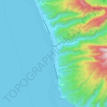
Name: Pāʻea topographic map, elevation, terrain.

Location: Pāʻea, Windward Islands, French Polynesia, 98711, France (-17.74743 -149.59634 -17.64485 -149.50062)

Average elevation: 252 m

Minimum elevation: 0 m

Maximum elevation: 1,461 m

Other topographic maps

Click on a map to view its topography, its elevation and its terrain.

Maraa

France > French Polynesia > Windward Islands > Punaʻauiʻa

Average elevation: 678 m

Gear up for your next adventure:

🧳Compression Sacks - Maximize space in your backpack by shrinking gear
💧Filtered Water Bottle - Safe drinking water on the go
🦶Hiking Shoe Insoles - Added support for high arches and long days on feet
🧥Ultralight Puffy Jacket - Maximum warmth that packs down to the size of an orange
🧢Sun Protection Cap - Breathable cap to protect from sun exposure

As an Amazon Associate, this site earns from qualifying purchases at no extra cost to you.