Geolocate

Fairfield topographic map

Click on the map to display elevation.

About this map

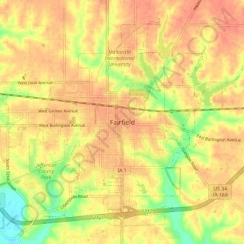
Name: Fairfield topographic map, elevation, terrain.

Location: Fairfield, Jefferson County, Iowa, United States (40.98075 -92.00677 41.03369 -91.92440)

Average elevation: 230 m

Minimum elevation: 200 m

Maximum elevation: 244 m

Gear up for your next adventure:

🥾Trail Hiking Boots - Supportive boots for rough trails
🧥Insulated Jacket - Keep warm in cold outdoor conditions
🔋Lithium AA Batteries - Long-lasting power that performs in extreme cold
💡LED Camping Lantern - Illuminate your campsite with long-lasting lanterns
🛏️Sleeping Bag - Warm and compact sleeping bags for outdoor camping

As an Amazon Associate, this site earns from qualifying purchases at no extra cost to you.