Geolocate

Ravello topographic map

Click on the map to display elevation.

About this map

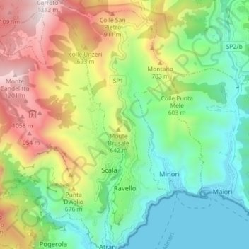
Name: Ravello topographic map, elevation, terrain.

Location: Ravello, Salerno, Campania, Italy (40.63649 14.57618 40.69037 14.62553)

Average elevation: 458 m

Minimum elevation: -4 m

Maximum elevation: 1,254 m

Other topographic maps

Click on a map to view its topography, its elevation and its terrain.

Positano

Italy > Campania > Salerno > Positano > Positano

Average elevation: 368 m

Serralunga

Italy > Campania > Salerno > Tortorella

Average elevation: 1,156 m

Gear up for your next adventure:

🥾Trail Hiking Boots - Supportive boots for rough trails
🧥Softshell Hiking Jacket - The perfect balance of wind protection and breathability
🔭Outdoor Binoculars - Lightweight binoculars for birdwatching and hiking
🪑Ultralight Camping Stool - Compact seating for rest stops during long hikes
❄️Traction Ice Cleats - Slip-on spikes for icy trails and winter hiking

As an Amazon Associate, this site earns from qualifying purchases at no extra cost to you.