Geolocate

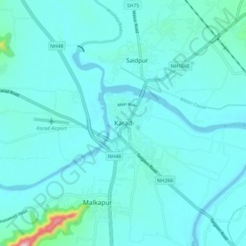
Karad topographic map

Click on the map to display elevation.

Karad

Karad is located at 17°17′N 74°12′E / 17.28°N 74.2°E / 17.28; 74.2. It has an average elevation of 566 metres (1857 feet). Karad is located near Agashiva caves 17°14′15″N 74°09′07″E / 17.237506°N 74.15205°E / 17.237506; 74.15205.

Wikipedia (CC-BY-SA 3.0)

About this map

Name: Karad topographic map, elevation, terrain.

Location: Karad, Satara, Maharashtra, 415100, India (17.24521 74.14221 17.32521 74.22221)

Average elevation: 580 m

Minimum elevation: 552 m

Maximum elevation: 853 m

Gear up for your next adventure:

🐕Hiking Dog Pack - Let your canine companion carry their own water and food
🔦LED Flashlight - Powerful and long-lasting flashlight for camping and emergencies
🔋Solar Power Bank - Keep your GPS and devices charged during long outdoor trips
🎒Fully Waterproof Backpack - Total protection for photography gear and electronics
🧤Thermal Hiking Gloves - Grip-enhanced gloves for cold-weather altitude trekking

As an Amazon Associate, this site earns from qualifying purchases at no extra cost to you.