Alamosa topographic map
Click on the map to display elevation.
Alamosa
Alamosa is located along the Rio Grande in the San Luis Valley, in the highest general agricultural land in the United States. Elevation is about 7,544 feet (2,299 m) in Alamosa with peaks over 14,000 feet (4,300 m) within 23 miles (37 km) of town in the Sangre de Cristo Range.
About this map
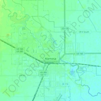
Name: Alamosa topographic map, elevation, terrain.
Location: Alamosa, Alamosa County, Colorado, 81101, United States (37.44111 -105.91372 37.50946 -105.84459)
Average elevation: 2,300 m
Minimum elevation: 2,295 m
Maximum elevation: 2,306 m
Other topographic maps
Click on a map to view its topography, its elevation and its terrain.


Blanca Peak
United States > Colorado > Alamosa County
Blanca Peak is notable not only for its absolute height, but also for its great local relief and dominant position at the end of the range, rising high above the San Luis Valley to the west. For example, it rises nearly 7,000 feet (2,100 m) over the edge of the San Luis Valley in only 6 miles (9.7 km). Blanca…
Average elevation: 3,870 m