
Thank you for supporting this site ❤️
Make a donation
Make a donation
Gear up for your next adventure:
As an Amazon Associate, this site earns from qualifying purchases at no extra cost to you.
Cuadonga / Covadonga topographic map
Click on the map to display elevation.
Thank you for supporting this site ❤️
Make a donation
Make a donation
Gear up for your next adventure:
As an Amazon Associate, this site earns from qualifying purchases at no extra cost to you.
About this map
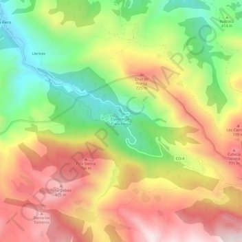
Name: Cuadonga / Covadonga topographic map, elevation, terrain.
Location: Cuadonga / Covadonga, Cangas de Onís, Asturias, 33589, Spain (43.28799 -5.07180 43.32799 -5.03180)
Average elevation: 504 m
Minimum elevation: 121 m
Maximum elevation: 883 m
Thank you for supporting this site ❤️
Make a donation
Make a donation
Gear up for your next adventure:
As an Amazon Associate, this site earns from qualifying purchases at no extra cost to you.
Other topographic maps
Click on a map to view its topography, its elevation and its terrain.