
Thank you for supporting this site ❤️
Make a donation
Make a donation
Gear up for your next adventure:
As an Amazon Associate, this site earns from qualifying purchases at no extra cost to you.
Halgan topographic map
Click on the map to display elevation.
Thank you for supporting this site ❤️
Make a donation
Make a donation
Gear up for your next adventure:
As an Amazon Associate, this site earns from qualifying purchases at no extra cost to you.
About this map
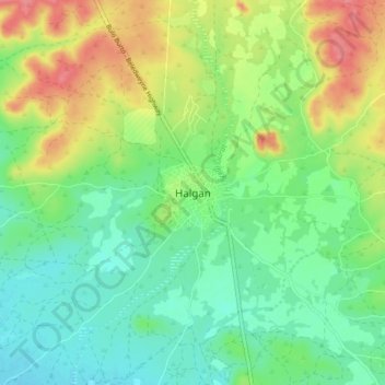
Name: Halgan topographic map, elevation, terrain.
Location: Halgan, Buloburde District, Hiiraan, Hirshabelle, Somalia (4.17111 45.52037 4.25111 45.60037)
Average elevation: 194 m
Minimum elevation: 167 m
Maximum elevation: 239 m
Thank you for supporting this site ❤️
Make a donation
Make a donation
Gear up for your next adventure:
As an Amazon Associate, this site earns from qualifying purchases at no extra cost to you.