
Thank you for supporting this site ❤️
Make a donation
Make a donation
Gear up for your next adventure:
As an Amazon Associate, this site earns from qualifying purchases at no extra cost to you.
Joliette topographic map
Click on the map to display elevation.
Thank you for supporting this site ❤️
Make a donation
Make a donation
Gear up for your next adventure:
As an Amazon Associate, this site earns from qualifying purchases at no extra cost to you.
About this map
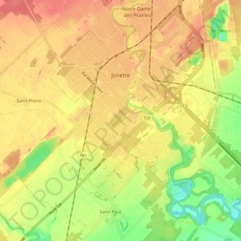
Name: Joliette topographic map, elevation, terrain.
Location: Joliette, Joliette (MRC), Lanaudière, Quebec, Canada (45.97729 -73.47161 46.04407 -73.37109)
Average elevation: 52 m
Minimum elevation: 17 m
Maximum elevation: 75 m
Joliette (MRC) trails, hiking, mountain biking, running and outdoor activities
Thank you for supporting this site ❤️
Make a donation
Make a donation
Gear up for your next adventure:
As an Amazon Associate, this site earns from qualifying purchases at no extra cost to you.