Geolocate

Belfast topographic map

Click on the map to display elevation.

About this map

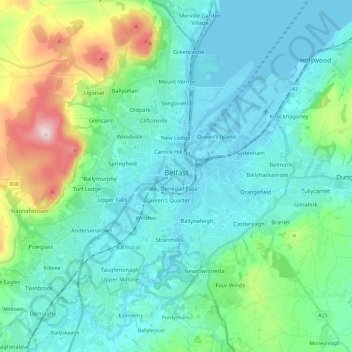
Name: Belfast topographic map, elevation, terrain.

Location: Belfast, County Antrim, Northern Ireland, United Kingdom (54.53061 -6.04548 54.65942 -5.80769)

Average elevation: 92 m

Minimum elevation: -2 m

Maximum elevation: 476 m

Gear up for your next adventure:

🛏️Sleeping Bag - Warm and compact sleeping bags for outdoor camping
🧥Waterproof Hiking Jacket - Protect yourself from rain and wind while hiking
🧴Outdoor Sunscreen - High SPF protection for high-altitude UV exposure
🧰Emergency Multi-Tool - Compact multi-tool for outdoor survival
🧥Fleece Jacket - Warm and lightweight jacket for layering

As an Amazon Associate, this site earns from qualifying purchases at no extra cost to you.