Geolocate

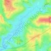
Saint-Prix topographic map

Click on the map to display elevation.

About this map

Name: Saint-Prix topographic map, elevation, terrain.

Location: Saint-Prix, Autun, Saône-et-Loire, Bourgogne – Franche-Comté, Metropolitan France, 71990, France (46.93515 3.99369 47.00531 4.10355)

Average elevation: 593 m

Minimum elevation: 350 m

Maximum elevation: 906 m

Other topographic maps

Click on a map to view its topography, its elevation and its terrain.
Gear up for your next adventure:

🧦Outdoor Socks - Durable socks designed for hiking and outdoor sports
⛺Camping Tent - Weather-resistant tents suitable for 2 to 6 people
🛶Kayak Accessories - Essential gear for safe and fun kayaking adventures
🥾Hiking Leggings - Comfortable leggings for outdoor activities
🧼Travel Hand Sanitizer - Keep hands clean when water is scarce

As an Amazon Associate, this site earns from qualifying purchases at no extra cost to you.