Geolocate

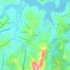
Nazareno topographic map

Click on the map to display elevation.

About this map

Name: Nazareno topographic map, elevation, terrain.

Location: Nazareno, Região Geográfica Imediata de São João del Rei, Região Geográfica Intermediária de Juiz de Fora, Minas Gerais, Southeast Region, Brazil (-21.34583 -44.73300 -21.08010 -44.46418)

Average elevation: 934 m

Minimum elevation: 821 m

Maximum elevation: 1,242 m

Other topographic maps

Click on a map to view its topography, its elevation and its terrain.
Gear up for your next adventure:

🧥Softshell Jacket - Windproof and breathable jacket for hiking
💧Hydration Bladder - Hands-free hydration solution for long treks
💧Filtered Water Bottle - Safe drinking water on the go
💡LED Camping Lantern - Illuminate your campsite with long-lasting lanterns
🎒Backpack Rain Cover - External shield to keep your entire pack dry

As an Amazon Associate, this site earns from qualifying purchases at no extra cost to you.