Geolocate

Güstrow topographic map

Click on the map to display elevation.

About this map
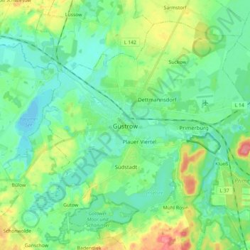
Name: Güstrow topographic map, elevation, terrain.

Location: Güstrow, Landkreis Rostock, Mecklenburg-Vorpommern, Germany (53.75092 12.11902 53.83711 12.29445)

Average elevation: 19 m

Minimum elevation: 0 m

Maximum elevation: 65 m

Gear up for your next adventure:

🧰Survival Kit - Essential gear for emergencies in the wilderness
☕Camping Coffee Maker - Brew fresh coffee anywhere on the topographic map
🥾Approach Shoes - Shoes designed for climbing approaches and rugged trails
🛰️Satellite Messenger - Emergency communication for areas with no cell service
🛶Canoe Life Vest - Safety vest for water sports

As an Amazon Associate, this site earns from qualifying purchases at no extra cost to you.