
Thank you for supporting this site ❤️
Make a donation
Make a donation
Gear up for your next adventure:
As an Amazon Associate, this site earns from qualifying purchases at no extra cost to you.
Sotrondio topographic map
Click on the map to display elevation.
Thank you for supporting this site ❤️
Make a donation
Make a donation
Gear up for your next adventure:
As an Amazon Associate, this site earns from qualifying purchases at no extra cost to you.
About this map
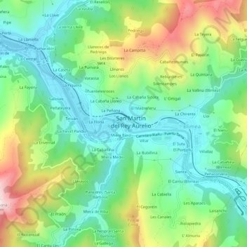
Name: Sotrondio topographic map, elevation, terrain.
Location: Sotrondio, Samartín del Rei Aurelio, Asturias, 33960, Spain (43.25498 -5.62567 43.29498 -5.58567)
Average elevation: 424 m
Minimum elevation: 233 m
Maximum elevation: 807 m
Thank you for supporting this site ❤️
Make a donation
Make a donation
Gear up for your next adventure:
As an Amazon Associate, this site earns from qualifying purchases at no extra cost to you.