
Navacerrada topographic map
Click on the map to display elevation.
Navacerrada
Navacerrada is a municipality of the Community of Madrid, Spain. It lies at an elevation of 1,203 metres (3,947 ft) on the Reservoir Navacerrada and the entry of "Valle de la Barranca" in the Sierra de Guadarrama.
About this map
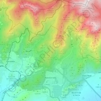
Name: Navacerrada topographic map, elevation, terrain.
Location: Navacerrada, Community of Madrid, 28491, Spain (40.71089 -4.04219 40.78840 -3.96863)
Average elevation: 1,460 m
Minimum elevation: 1,005 m
Maximum elevation: 2,267 m
Other topographic maps
Click on a map to view its topography, its elevation and its terrain.