Geolocate

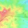
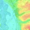
Montmarault topographic map

Click on the map to display elevation.

About this map

Name: Montmarault topographic map, elevation, terrain.

Location: Montmarault, Montluçon, Allier, Auvergne-Rhône-Alpes, Metropolitan France, 03390, France (46.29868 2.92186 46.33388 2.99087)

Average elevation: 440 m

Minimum elevation: 346 m

Maximum elevation: 495 m

Other topographic maps

Click on a map to view its topography, its elevation and its terrain.

Les Turiers

France > Auvergne-Rhône-Alpes > Allier > Beaulon

Average elevation: 241 m

Gagnon

France > Auvergne-Rhône-Alpes > Allier > Arfeuilles

Average elevation: 553 m

Garbat

France > Auvergne-Rhône-Alpes > Allier > Billy

Average elevation: 276 m

Le Bouchon

France > Auvergne-Rhône-Alpes > Allier > Tronget

Average elevation: 430 m

Les Noix

France > Auvergne-Rhône-Alpes > Allier > Cressanges

Average elevation: 396 m

Champage

France > Auvergne-Rhône-Alpes > Allier > Coutansouze

Average elevation: 550 m

Péraclos

France > Auvergne-Rhône-Alpes > Allier > Chouvigny

Average elevation: 417 m

Les Boudeaux

France > Auvergne-Rhône-Alpes > Allier > Le Pin

Average elevation: 282 m

Gear up for your next adventure:

💡LED Camping Lantern - Illuminate your campsite with long-lasting lanterns
🧢Beanie Hat - Keep your head warm in cold weather
🥾Durable Hiking Shoes - Long-lasting shoes for frequent hiking
🥾Light Trekking Boots - Supportive boots for multi-day treks
🧰Multitool Knife - Compact and versatile tool for outdoor use

As an Amazon Associate, this site earns from qualifying purchases at no extra cost to you.