Geolocate

Newport topographic map

Click on the map to display elevation.

About this map
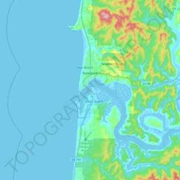
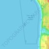
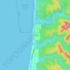
Name: Newport topographic map, elevation, terrain.

Location: Newport, Lincoln County, Oregon, United States (44.54514 -124.08238 44.69916 -124.01213)

Average elevation: 33 m

Minimum elevation: -9 m

Maximum elevation: 265 m

Other topographic maps

Click on a map to view its topography, its elevation and its terrain.
Otter Rock

United States > Oregon > Lincoln County

Average elevation: 6 m

Logsden

United States > Oregon > Lincoln County

Average elevation: 119 m

Tidewater

United States > Oregon > Lincoln County

Average elevation: 222 m

Seal Rock

United States > Oregon > Lincoln County

Average elevation: 6 m

Bayshore

United States > Oregon > Lincoln County

Average elevation: 15 m

Beverly Beach

United States > Oregon > Lincoln County

Average elevation: 29 m

Tidewater

United States > Oregon > Lincoln County

Average elevation: 222 m

Eddyville

United States > Oregon > Lincoln County

Average elevation: 131 m

Agate Beach

United States > Oregon > Lincoln County > Newport

Average elevation: 42 m

Logsden

United States > Oregon > Lincoln County

Average elevation: 119 m

Gear up for your next adventure:

🧭GPS Tracker - Track your location in remote areas safely
🧭GPS Outdoor Watch - Smart watch for navigation and fitness tracking in nature
🥾Mountain Hiking Boots - High-traction boots for rocky terrain
🧥Insulated Jacket - Keep warm in cold outdoor conditions
🧦Hiking Socks - Moisture-wicking and comfortable socks for long hikes

As an Amazon Associate, this site earns from qualifying purchases at no extra cost to you.