
Perumbavoor topographic map
Click on the map to display elevation.
About this map
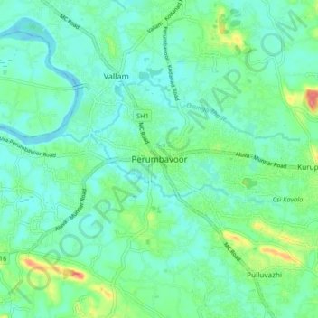
Name: Perumbavoor topographic map, elevation, terrain.
Location: Perumbavoor, Kunnathunad, Ernakulam, Kerala, 683500, India (10.07475 76.43782 10.15475 76.51782)
Average elevation: 20 m
Minimum elevation: 0 m
Maximum elevation: 82 m
Other topographic maps
Click on a map to view its topography, its elevation and its terrain.