Geolocate

Worthington topographic map

Click on the map to display elevation.

About this map

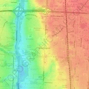
Name: Worthington topographic map, elevation, terrain.

Location: Worthington, Sharon Township, Franklin, Ohio, United States (40.07439 -83.05525 40.11535 -82.99564)

Average elevation: 262 m

Minimum elevation: 225 m

Maximum elevation: 287 m

Gear up for your next adventure:

🩹Compact First Aid Kit - Pre-packed essentials for common trail injuries
🥾Approach Boots - Comfortable boots for hiking and climbing approaches
👟Sport Hiking Sandals - Breathable footwear for water crossings and camp rest
🪑Insulated Seat Pad - Protect your seat from cold rocks and wet logs
Lightweight Camping Tent - Portable shelter optimized for Canadian backcountry camping

As an Amazon Associate, this site earns from qualifying purchases at no extra cost to you.