
Thank you for supporting this site ❤️
Make a donation
Make a donation
Gear up for your next adventure:
As an Amazon Associate, this site earns from qualifying purchases at no extra cost to you.
Maghnia topographic map
Click on the map to display elevation.
Thank you for supporting this site ❤️
Make a donation
Make a donation
Gear up for your next adventure:
As an Amazon Associate, this site earns from qualifying purchases at no extra cost to you.
About this map
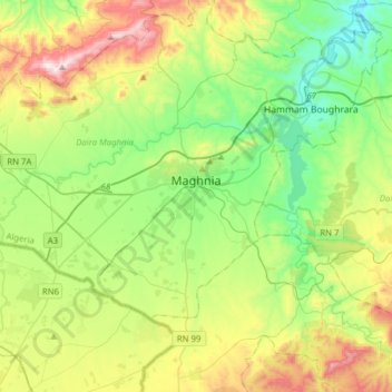
Name: Maghnia topographic map, elevation, terrain.
Location: Maghnia, Maghnia District, Tilimsen, Algeria (34.75638 -1.97452 34.91693 -1.66292)
Average elevation: 468 m
Minimum elevation: 199 m
Maximum elevation: 1,011 m
Thank you for supporting this site ❤️
Make a donation
Make a donation
Gear up for your next adventure:
As an Amazon Associate, this site earns from qualifying purchases at no extra cost to you.