
Cumberland topographic map
Interactive map
Click on the map to display elevation.
About this map
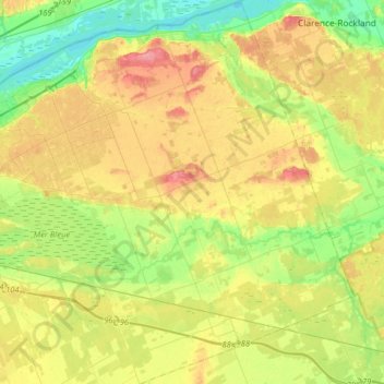
Name: Cumberland topographic map, elevation, terrain.
Average elevation: 75 m
Minimum elevation: 38 m
Maximum elevation: 124 m
Other topographic maps
Click on a map to view its topography, its elevation and its terrain.
Orléans
Canada > Ontario > Ottawa > Cumberland
Orléans, Cumberland, Ottawa, Eastern Ontario, Ontario, Canada
Average elevation: 66 m
Beckett's Creek
Canada > Ontario > Ottawa > Cumberland
Beckett's Creek, Cumberland, Ottawa, Eastern Ontario, Ontario, K0A 3E0, Canada
Average elevation: 87 m
Notting Gate
Canada > Ontario > Ottawa > Cumberland
Notting Gate, Cumberland, Ottawa, Ontario, Canada
Average elevation: 89 m