Geolocate

Tacna topographic map

Click on the map to display elevation.

About this map

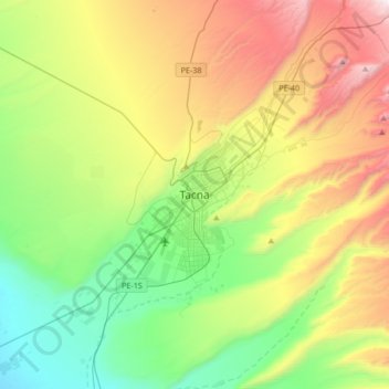
Name: Tacna topographic map, elevation, terrain.

Location: Tacna, Province of Tacna, Tacna, 23001, Peru (-18.17385 -70.41116 -17.85385 -70.09116)

Average elevation: 735 m

Minimum elevation: 123 m

Maximum elevation: 1,825 m

Gear up for your next adventure:

🪜Heavy Duty Carabiners - Multi-use clips for securing gear to your backpack
📷Outdoor Action Camera - Capture high-elevation views and rugged adventures
🧭GPS Outdoor Watch - Smart watch for navigation and fitness tracking in nature
🛶Waterproof Dry Bags - Keep electronics and clothes dry during river crossings
🎒Fully Waterproof Backpack - Total protection for photography gear and electronics

As an Amazon Associate, this site earns from qualifying purchases at no extra cost to you.