Geolocate

Pedreguer topographic map

Click on the map to display elevation.

About this map
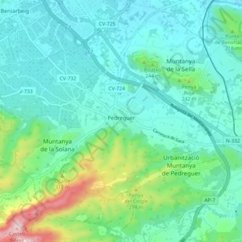
Name: Pedreguer topographic map, elevation, terrain.

Location: Pedreguer, la Marina Alta, Alacant / Alicante, Valencian Community, 03750, Spain (38.76357 -0.00925 38.82231 0.07300)

Average elevation: 132 m

Minimum elevation: 16 m

Maximum elevation: 584 m

Other topographic maps

Click on a map to view its topography, its elevation and its terrain.

Los Solaines

Spain > Valencian Community > Villena

Average elevation: 690 m

Gear up for your next adventure:

🎒Hiking Backpack - Lightweight and ergonomic backpacks for day hikes or multi-day treks
🥾Durable Hiking Shoes - Long-lasting shoes for frequent hiking
👟Trail Running Shoes - Agile footwear for fast-paced topographic exploration
🛶Waterproof Dry Bags - Keep electronics and clothes dry during river crossings
🧢Sun Protection Cap - Breathable cap to protect from sun exposure

As an Amazon Associate, this site earns from qualifying purchases at no extra cost to you.