Geolocate

Okrokana topographic map

Click on the map to display elevation.

About this map

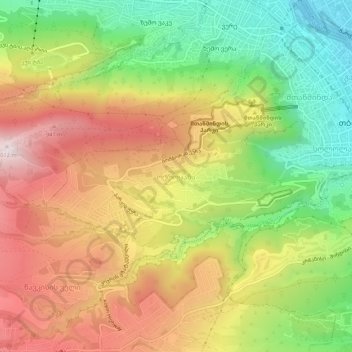
Name: Okrokana topographic map, elevation, terrain.

Location: Okrokana, Tbilisi, 0105, Georgia (41.66738 44.75355 41.70738 44.79355)

Average elevation: 697 m

Minimum elevation: 392 m

Maximum elevation: 1,011 m

Gear up for your next adventure:

🔋Emergency Crank Radio - Weather alerts and power without needing batteries
💡Portable Camping Lamp - Rechargeable lamp for campsite lighting
🥾Trail Hiking Socks - Comfortable socks to prevent blisters and fatigue
🥾Hiking Leggings - Comfortable leggings for outdoor activities
🧦Hiking Liner Socks - Thin base layer to prevent friction and blisters

As an Amazon Associate, this site earns from qualifying purchases at no extra cost to you.