Geolocate

Talegaon Dabhade topographic map

Click on the map to display elevation.

About this map
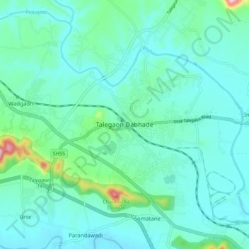
Name: Talegaon Dabhade topographic map, elevation, terrain.

Location: Talegaon Dabhade, Mawal, Maharashtra, 410506, India (18.71371 73.65286 18.75371 73.69286)

Average elevation: 622 m

Minimum elevation: 581 m

Maximum elevation: 738 m

Gear up for your next adventure:

⛺Backpacking Tent - Lightweight tent for long-distance hiking trips
🩹Compact First Aid Kit - Pre-packed essentials for common trail injuries
🏕️Camping Hammock - Integrated protection for sleeping between trees
🧴Outdoor Sunscreen - High SPF protection for high-altitude UV exposure
🥾Light Hiking Boots - Lightweight and comfortable boots for day hikes

As an Amazon Associate, this site earns from qualifying purchases at no extra cost to you.