Geolocate

Cetara topographic map

Click on the map to display elevation.

About this map
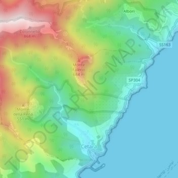
Name: Cetara topographic map, elevation, terrain.

Location: Cetara, Salerno, Campania, Italy (40.64586 14.67452 40.66916 14.71246)

Average elevation: 260 m

Minimum elevation: 0 m

Maximum elevation: 833 m

Gear up for your next adventure:

🛶Canoe Life Vest - Safety vest for water sports
🧢Sun Hat - Wide-brim hat for sun protection
🔭Compact Monocular - One-handed bird watching and trail spotting
🥾Hiking Shorts - Breathable shorts suitable for summer hikes
🧰Multitool Knife - Compact and versatile tool for outdoor use

As an Amazon Associate, this site earns from qualifying purchases at no extra cost to you.