
Taku topographic map
Interactive map
Click on the map to display elevation.
About this map
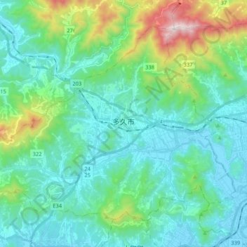
Name: Taku topographic map, elevation, terrain.
Location: Taku, Saga Prefecture, Japan (33.23426 130.02221 33.34012 130.18280)
Average elevation: 205 m
Minimum elevation: -2 m
Maximum elevation: 1,041 m