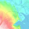
Al-Faw topographic map
Click on the map to display elevation.
Al-Faw
Another view suggests that the name is derived from the city’s position at the mouth (fāh) of the Shatt al-Arab, which evolved linguistically into Faw. Some sources, however, argue that the original word was al-Faʾu (الفأو), meaning “open land visible to the eye” or “land enclosed between two elevations”.
About this map

Name: Al-Faw topographic map, elevation, terrain.
Location: Al-Faw, Al-Faw District, Basra Governorate, Iraq (29.93440 48.43183 30.01440 48.51183)
Average elevation: 1 m
Minimum elevation: -4 m
Maximum elevation: 4 m
Other topographic maps
Click on a map to view its topography, its elevation and its terrain.