Geolocate

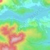
Isola di Capo Rizzuto topographic map

Click on the map to display elevation.

About this map

Name: Isola di Capo Rizzuto topographic map, elevation, terrain.

Location: Isola di Capo Rizzuto, Crotone, Calabria, 88841, Italy (38.89247 16.98469 39.02649 17.17216)

Average elevation: 72 m

Minimum elevation: -1 m

Maximum elevation: 207 m

Other topographic maps

Click on a map to view its topography, its elevation and its terrain.

Marinella

Italy > Calabria > Crotone > Crotone

Average elevation: 10 m

Villaggio Palumbo

Italy > Calabria > Crotone

Average elevation: 1,385 m

Papanice

Italy > Calabria > Crotone > Crotone

Average elevation: 106 m

Gear up for your next adventure:

🧊Insulated Water Bottle - Keeps drinks cold in summer and prevents freezing in winter
🔋Emergency Crank Radio - Weather alerts and power without needing batteries
🧢Sun Hat - Wide-brim hat for sun protection
🛌Down Sleeping Bag - Superior warmth-to-weight ratio for cold nights
🥾Trekking Poles - Adjustable trekking poles to reduce knee stress and improve stability

As an Amazon Associate, this site earns from qualifying purchases at no extra cost to you.