Geolocate

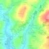
Laurenan topographic map

Click on the map to display elevation.

About this map

Name: Laurenan topographic map, elevation, terrain.

Location: Laurenan, Saint-Brieuc, Côtes-d'Armor, Brittany, Metropolitan France, 22230, France (48.17538 -2.56476 48.25213 -2.45553)

Average elevation: 199 m

Minimum elevation: 123 m

Maximum elevation: 305 m

Other topographic maps

Click on a map to view its topography, its elevation and its terrain.
Malher

France > Brittany > Côtes-d'Armor > Le Fœil

Average elevation: 208 m

Bomel

France > Brittany > Côtes-d'Armor > Saint-Maudan

Average elevation: 104 m

Gear up for your next adventure:

🩹Compact First Aid Kit - Pre-packed essentials for common trail injuries
🥾Hiking Shoes - Durable and comfortable shoes for trail hiking
🚲Handlebar Phone Mount - View topographic-map.com live while cycling
⛺Camping Essentials - All-in-one gear for a comfortable camping trip
🩹Moleskin Blister Pads - Direct protection for painful foot pressure points

As an Amazon Associate, this site earns from qualifying purchases at no extra cost to you.