
Thank you for supporting this site ❤️
Make a donation
Make a donation
Gear up for your next adventure:
As an Amazon Associate, this site earns from qualifying purchases at no extra cost to you.
Fretheim topographic map
Click on the map to display elevation.
Thank you for supporting this site ❤️
Make a donation
Make a donation
Gear up for your next adventure:
As an Amazon Associate, this site earns from qualifying purchases at no extra cost to you.
About this map
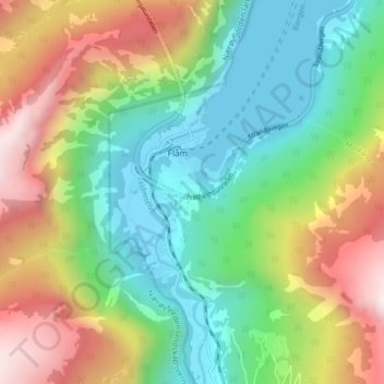
Name: Fretheim topographic map, elevation, terrain.
Location: Fretheim, Flåm, Aurland, Vestland, 5743, Norway (60.83855 7.09709 60.87855 7.13709)
Average elevation: 463 m
Minimum elevation: -1 m
Maximum elevation: 1,288 m
Thank you for supporting this site ❤️
Make a donation
Make a donation
Gear up for your next adventure:
As an Amazon Associate, this site earns from qualifying purchases at no extra cost to you.