
Thank you for supporting this site ❤️
Make a donation
Make a donation
Gear up for your next adventure:
As an Amazon Associate, this site earns from qualifying purchases at no extra cost to you.
Cavtat topographic map
Click on the map to display elevation.
Thank you for supporting this site ❤️
Make a donation
Make a donation
Gear up for your next adventure:
As an Amazon Associate, this site earns from qualifying purchases at no extra cost to you.
About this map
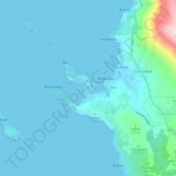
Name: Cavtat topographic map, elevation, terrain.
Location: Cavtat, Općina Konavle, Dubrovnik-Neretva County, Croatia (42.56425 18.20787 42.60060 18.25046)
Average elevation: 49 m
Minimum elevation: -1 m
Maximum elevation: 539 m
Thank you for supporting this site ❤️
Make a donation
Make a donation
Gear up for your next adventure:
As an Amazon Associate, this site earns from qualifying purchases at no extra cost to you.