
Make a donation
Gear up for your next adventure:
As an Amazon Associate, this site earns from qualifying purchases at no extra cost to you.
Palos Township topographic map
Click on the map to display elevation.
Make a donation
Gear up for your next adventure:
As an Amazon Associate, this site earns from qualifying purchases at no extra cost to you.
About this map
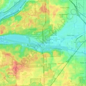
Name: Palos Township topographic map, elevation, terrain.
Location: Palos Township, Cook County, Illinois, United States (41.64395 -87.91425 41.73349 -87.79573)
Average elevation: 202 m
Minimum elevation: 176 m
Maximum elevation: 239 m
Make a donation
Gear up for your next adventure:
As an Amazon Associate, this site earns from qualifying purchases at no extra cost to you.
Other topographic maps
Click on a map to view its topography, its elevation and its terrain.
Chicago, North Shore & Milwaukee
United States > Illinois > Cook County > Northbrook > Williamsburg Square
Average elevation: 198 m
Make a donation
Gear up for your next adventure:
As an Amazon Associate, this site earns from qualifying purchases at no extra cost to you.