Geolocate

Golden Lake topographic map

Click on the map to display elevation.

About this map
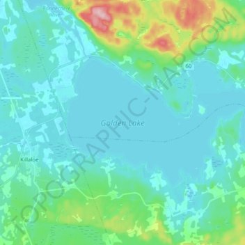
Name: Golden Lake topographic map, elevation, terrain.

Location: Golden Lake, North Algona Wilberforce, Renfrew County, Eastern Ontario, Ontario, Canada (45.54377 -77.39495 45.60183 -77.23975)

Average elevation: 195 m

Minimum elevation: 167 m

Maximum elevation: 344 m

Renfrew County trails, hiking, mountain biking, running and outdoor activities

Gear up for your next adventure:

👟Leg Gaiters - Keep debris, mud, and snow out of your boots
🧢Hiking Sun Hat - Wide-brimmed protection for exposed mountain ridges
🔦LED Headlamp - Hands-free lighting for early morning starts or late finishes
🥾Mountaineering Boots - Supportive boots for climbing and high-altitude hiking
🕯️Camping Lantern - Illuminates your entire campsite with high-efficiency LEDs

As an Amazon Associate, this site earns from qualifying purchases at no extra cost to you.