Geolocate

Colbún topographic map

Click on the map to display elevation.

About this map

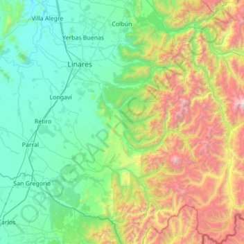
Name: Colbún topographic map, elevation, terrain.

Location: Colbún, Provincia de Linares, Maule Region, 3610000, Chile (-36.50576 -71.51830 -35.61012 -70.56993)

Average elevation: 837 m

Minimum elevation: 70 m

Maximum elevation: 3,540 m

Other topographic maps

Click on a map to view its topography, its elevation and its terrain.

Bellavista

Chile > Maule Region > Provincia de Linares > Linares

Average elevation: 416 m

Gear up for your next adventure:

🔥Camping Stove - Portable stoves to cook outdoors with ease
🧢Outdoor Cap - Protective cap for sun and rain during hikes
🍽️Titanium Camping Spork - Ultralight and indestructible eating utensil
Lightweight Backpacking Tent - Compact tent for efficient hiking trips
🦶Hiking Shoe Insoles - Added support for high arches and long days on feet

As an Amazon Associate, this site earns from qualifying purchases at no extra cost to you.