Geolocate

Troyes topographic map

Click on the map to display elevation.

About this map
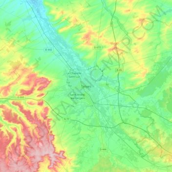
Name: Troyes topographic map, elevation, terrain.

Location: Troyes, Aube, Grand Est, Metropolitan France, 10000, France (48.13716 3.91463 48.45716 4.23463)

Average elevation: 151 m

Minimum elevation: 85 m

Maximum elevation: 302 m

Gear up for your next adventure:

🧢Hiking Hat - Sun-protective and breathable hats for long treks
🥾Light Trekking Boots - Supportive boots for multi-day treks
🦶Anti-Blister Balm - Prevents friction and hotspots during long ascents
🦌Outdoor Trail Camera - Monitor wildlife activity near your favorite spots
🧴Outdoor Sunscreen - High SPF protection for high-altitude UV exposure

As an Amazon Associate, this site earns from qualifying purchases at no extra cost to you.