

Randogne topographic map
Click on the map to display elevation.
Randogne
The former municipality is located in the Sierre district, on the northern slope of the Rhone valley. The municipality goes from the Rhone valley at an elevation of 540 m (1,770 ft) to Mont Bonvin at 2,995 m (9,826 ft). It consists of the village of Randogne (which was rebuilt in stone after the destructive fire of 1898), the village of Loc, portions of the village of Darnona and Bluche, as well as the majority of the resort of Montana-Vermala and Montana-Station.
About this map
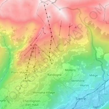
Name: Randogne topographic map, elevation, terrain.
Location: Randogne, Crans-Montana, Sierre, Wallis, 3960, Switzerland (46.28388 7.47796 46.37191 7.51993)
Average elevation: 1,614 m
Minimum elevation: 521 m
Maximum elevation: 2,977 m
Other topographic maps
Click on a map to view its topography, its elevation and its terrain.

Les Briesses
Switzerland > Wallis > Sierre > Crans-Montana > Chermignon-d'en-Bas
Average elevation: 1,179 m