
Make a donation
Gear up for your next adventure:
As an Amazon Associate, this site earns from qualifying purchases at no extra cost to you.
Pont-Rouge topographic map
Click on the map to display elevation.
Make a donation
Gear up for your next adventure:
As an Amazon Associate, this site earns from qualifying purchases at no extra cost to you.
About this map
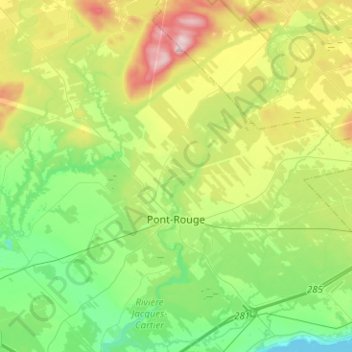
Name: Pont-Rouge topographic map, elevation, terrain.
Average elevation: 117 m
Minimum elevation: -1 m
Maximum elevation: 356 m
Portneuf (MRC) trails, hiking, mountain biking, running and outdoor activities
Make a donation
Gear up for your next adventure:
As an Amazon Associate, this site earns from qualifying purchases at no extra cost to you.
Other topographic maps
Click on a map to view its topography, its elevation and its terrain.
Lac de la Tête de Jument
Canada > Quebec > Portneuf (MRC) > Saint-Léonard-de-Portneuf
Average elevation: 371 m
Make a donation
Gear up for your next adventure:
As an Amazon Associate, this site earns from qualifying purchases at no extra cost to you.